Irresponsible Development
For future generations
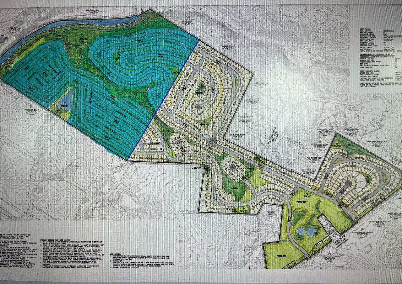
Floyds Fork is 62 miles long, with the Metro Louisville responsible for 31 miles. In 1993, the city set up the Floyds Fork Special District Development Review Overlay (DRO) to protect 15,000 acres of this environmentally sensitive area. To set this land aside for future generations, the floodplain surrounding Floyds Fork was recommended for agricultural and recreational usage only. This has traditionally been the case as evidenced by the average lot size was ~10 acres per dwelling.
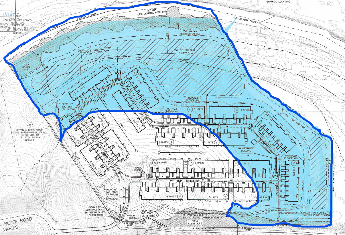
This is an example of an APPROVED major subdivision located on Aiken Rd within the DRO! The blue highlighted area is all within the DRO. The "Green Space" in the bottom right corner will not remain green space but is planned for future growth and development. Thus, this development located along a 1/2 mile of Floyds Fork will start with 866 houses and grow to over 1,000 with no playground, no club house, no recreational areas at all. The "green space" for these people will be the perennial stream that cuts through the property (that can't be developed) and the trenches the developer will have to dig in order to retain the water runoff (see pictures below for what these "green spaces" will look like!). We are taking beautiful land set aside for recreational and agricultural uses and turning them into environmental disasters.
Filling in the floodplain and channeling all the runoff to Floyds Fork
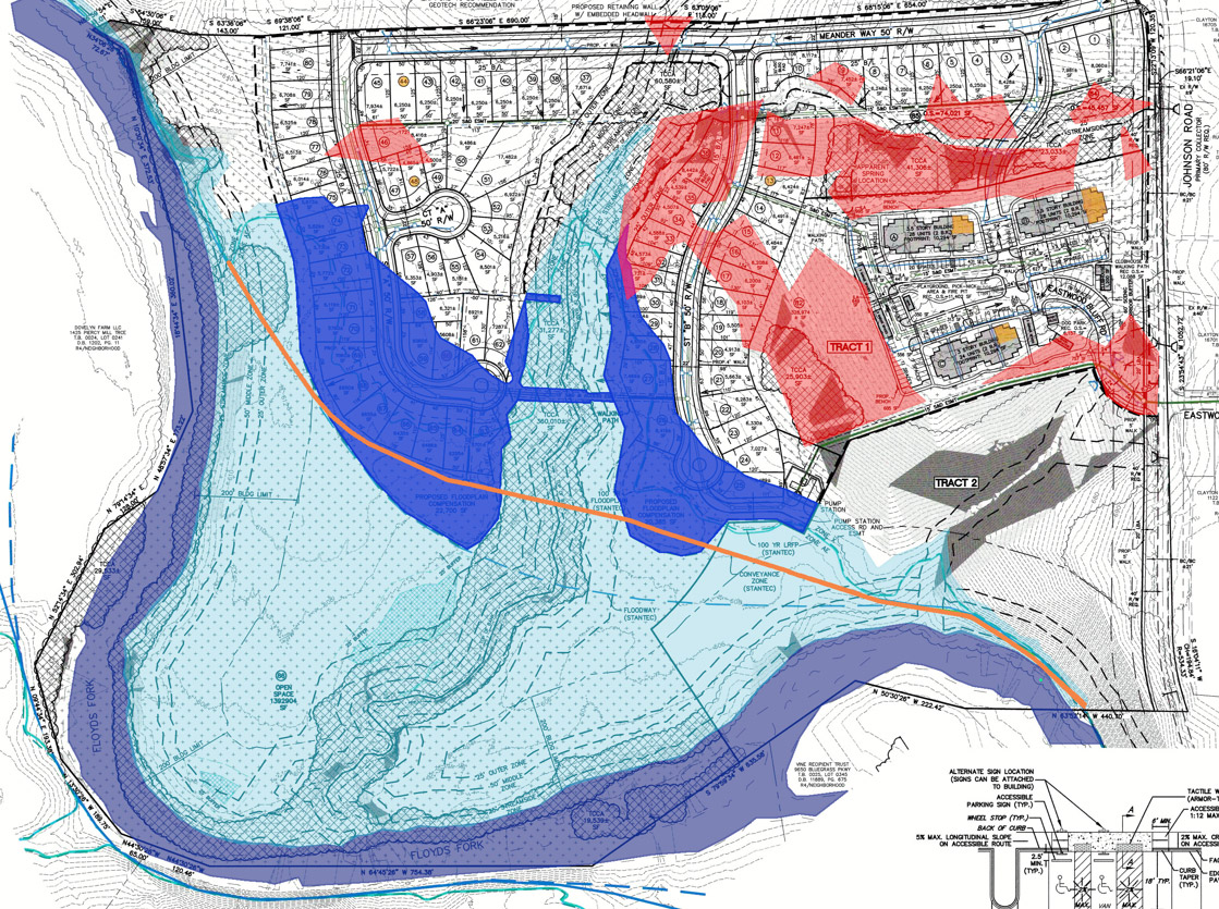
Filling in the floodplain and eliminating floodplain for smaller rain events
Filling in the floodplain, no water quality during actual flooding events